Where Streets End, Divides Begin
Rice sociologist Elizabeth Roberto is studying how dead-end streets, fences, railroad tracks and highways shape inequality across the U.S.
By Kat Cosley Trigg
As a graduate student in New Haven, Connecticut, Elizabeth Roberto couldn’t stop wondering why certain neighborhoods seemed connected while others were quietly walled off.
“There were these places where the roads just stopped,” she recalled. “Like they were meant to go somewhere — but didn’t.”
For most people, it might have been an unnoticed quirk of urban design. For Roberto, it became a question that would shape her career: What happens when barriers separate people — not just symbolically but literally?
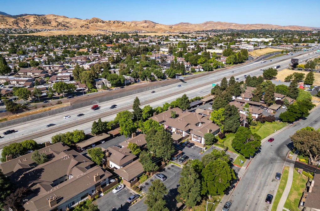
Now an assistant professor of sociology at Rice, Roberto has turned that curiosity into a pioneering line of research. Backed by a $500,000 National Science Foundation CAREER Award, she is studying how elements of the built environment — dead-end streets, highways, fences and railroad tracks — influence neighborhood separation and access to opportunity across U.S. cities.
“It’s something I’ve been thinking about for years,” she says. “This award is incredibly exciting, and honestly, I’m still processing it. It’s the culmination of so many years of work.”
While many scholars focus on economics, personal preferences or discrimination to explain residential segregation, Roberto’s work adds a physical dimension. Using satellite imagery, historical archives, redlining maps and artificial intelligence, her team is uncovering how infrastructure decisions — even the simple question of where a street goes or doesn’t — can reinforce racial and economic divides.
“You start to see these patterns repeating across the country,” Roberto says. “What I noticed in Connecticut wasn’t unique. Cities everywhere are shaped by the same forces.”
Her multiyear study will span 50 cities and introduce new methods for measuring how physical barriers affect access to schools, transit and public resources — not just mapping what’s there, but what’s missing.
At Rice, Roberto is also designing interdisciplinary courses in spatial analysis, urban inequality and data science, creating hands-on opportunities for students to engage in real-world research. She plans to launch an interactive public web platform to share her findings with policymakers, researchers and community leaders.
For Roberto, the work is about more than maps and measurements. It’s about making the invisible visible, helping cities, scholars and communities understand how decisions about streets, zoning and infrastructure shape the very fabric of opportunity.
“I’m not trying to say we should build more roads,” Roberto says. “But if we want to understand inequality, we need to see the ways physical infrastructure limits or enables access. This research is about creating tools that help us ask better questions about the way our cities are built — and for whom.”
From the Winter 2026 issue of Rice Magazine